What we miss when we don’t ask where
The scholarly metadata system has no field for the place a study studied. We checked all 50 fields of the OpenAlex record: every geographic one describes the authors’ employers or the journal’s website. Here is what that hides, and why “where” is not only about geography.
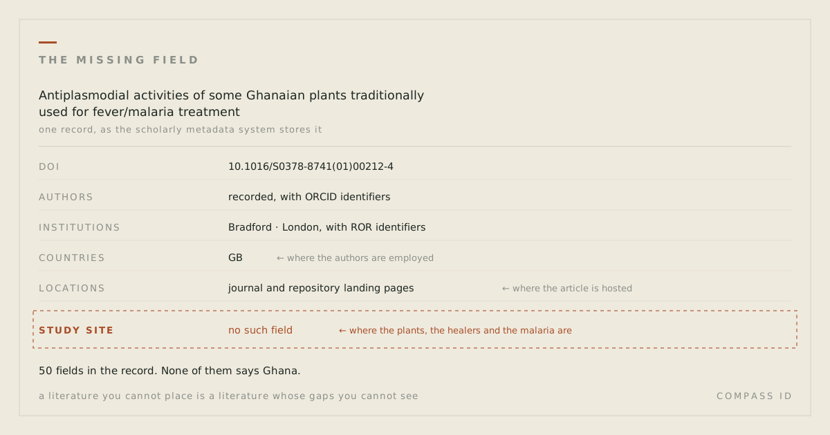
Take a 2001 paper in the Journal of Ethnopharmacology: Antiplasmodial activities of some Ghanaian plants traditionally used for fever/malaria treatment. It screens plants that Ghanaian healers use against fever, isolates alkaloids from one of them (Pleiocarpa mutica, in the same family as the periwinkle that gave medicine vincristine), and tests them against malaria parasites. Now ask the scholarly record where that research happened.
We pulled the full metadata record from OpenAlex, the open index that most modern literature tools are built on. It has 50 fields. Five of them sound geographic. Here is what each one actually holds:
primary_location,locations,best_oa_location: the journal and repository pages where the article can be downloaded.countries_distinct_count: derived from the authors’ institutions. For this paper the value is 1, and the country is the United Kingdom: all four authors were at Bradford, the University of London, and the London School of Hygiene & Tropical Medicine.institutions_distinct_count: the same thing, counted differently.
So the record says United Kingdom. The plants are Ghanaian, the traditional medicine is Ghanaian, the malaria burden is Ghanaian, and the word Ghana appears in none of the 50 fields. Count this paper the way a metadata query has to count it, and Britain is credited with a study of West African medicinal plants.
That matters more in drug discovery than almost anywhere else, because in natural-product research the place is the input. A plant grows where it grows; the knowledge of what it treats sits with the people who live there. Roll those papers up by author affiliation and you produce a map of where pharmacology departments are, then mistake it for a map of where the chemistry and the knowledge came from.
This is not a flaw in OpenAlex, which faithfully reports what publishers supply. It is a gap in the record itself. DOIs, ORCID, Crossref and OpenAlex between them describe who wrote a paper, where they are employed, what journal took it, and roughly what it is about. None of them carries a field for the place the work studied. Acheson and Purves put the problem plainly in 2021: this information sits in the article text as place names, with no accompanying machine-readable geographic metadata, and corpus analyses that do consider geography tend to fall back on author locations, because those are the easy ones to extract.
What that hides
The consequence is not that maps are nice to have. It is that an entire class of question cannot be asked at all, and the answers, where they have been worked out by hand, are uncomfortable.
Wilson and colleagues read over 10,000 conservation papers from more than 1,000 journals and found that comparatively less research is undertaken in the world’s most biodiverse countries, and that the science done in those countries is often not led by researchers based there. Their warning goes past the literature: indicators such as the Living Planet Index and the Red List Index will keep being populated with biased data. The skew does not stay in the journals. It flows into the numbers that policy runs on.
Christie and colleagues asked the practical version of the question: if you are standing somewhere and need evidence that an intervention works, how far away is the nearest relevant study? Across the Conservation Evidence database for amphibians and birds, they found fewer than one study per intervention within 2,000 km of a given location, and that only 17–20% of those studies used reliable designs. That is a measurement of distance between a decision and its evidence, and it is only computable once the literature has been placed.
A decade earlier, Martin, Blossey and Ellis located 2,573 terrestrial study sites from ten leading ecology journals and found ecologists clustered in protected areas, temperate deciduous woodlands and wealthy countries, leaving thin the 75% of the terrestrial world where people actually live and work. And Karl and colleagues, who built JournalMap to fix exactly this, summarised the absurdity in one line: it is easier to search the globe for research on the genes of a local plant than it is to find local research on that plant’s ecology.
“Where” is not only geography
The missing field is a coordinate system, and the Earth is only one of them. A study also happens somewhere in a body, somewhere in a cell, somewhere in a genome, and the record is equally silent about all of them.
Where someone has built the coordinate system, the same picture appears. Neurosynth extracted 100,953 activation coordinates from 3,489 neuroimaging papers and put them into a shared brain space, which made it possible to see which regions the literature had crowded into and which it had left alone. On the genome, Edwards and colleagues pointed out in 2011 that protein research was still concentrated on proteins known before the genome was sequenced; Stoeger and colleagues then showed that attention across human genes is predicted by a handful of chemical and biological properties that made experiments convenient in the 1980s and 1990s, rather than by physiological importance or relevance to disease. Roughly 2,000 of about 19,000 human genes absorb most of the work. The pattern is the one we keep finding in species: effort follows what was already easy to study.
Biomedicine is the partial counterexample, and it is instructive. MeSH, the vocabulary behind PubMed, organises its descriptors into 16 categories, and category A is anatomy, so biomedical papers carry at least a coarse index of where in the body they apply. Projects like the HuBMAP Human Reference Atlas, now covering 4,499 anatomical structures and 1,195 cell types in a common coordinate framework, extend that idea to data. The lesson is not that biology is special. It is that a location layer is something a field decides to build. Its absence elsewhere is a choice, not a law.
Data repositories are starting to show the same effect. A September 2026 preprint on Harvard Dataverse reports that only 0.3% of research datasets include a bounding box, yet datasets are twice as likely to connect across scientific disciplines through shared geospatial metadata as through keywords. Keyword vocabularies are discipline-specific; a place is not. Being a preprint, that finding is not yet peer-reviewed, but it points at something worth noticing: location may be a better bridge between fields than subject terms are.
What we do instead
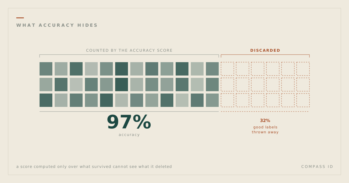
COMPASS ID reads each paper and records where the study happened, separately from where its authors work. The distinction is not rhetorical, and our own database shows exactly how stark it is.
- 54,720 author-affiliation placements in our corpus. Every one came from OpenAlex metadata, because that is the part metadata can answer.
- 72,287 study-site placements. Not one came from metadata. Every one was read out of the text of the paper, then resolved against a gazetteer.
- 35,124 papers now have a study site resolved to coordinates, across 200 countries.
Two honest limits. First, naming a place is not the same as mapping it: a substantial share of the study sites we extract are named in the text but cannot be resolved to coordinates with confidence, and we keep those flagged as unresolved rather than guessing. Second, every blank on our maps reads “no indexed research” and never “no research”. An absence in an index is a statement about the index. Our extraction is machine-assisted and measured against hand-built answer keys, and it is wrong some of the time; the published accuracy figures sit alongside every atlas.
What nobody has measured
We want to be careful about the size of the claim. There is good evidence for what becomes visible when a literature is placed on a map. There is very little evidence about what is lost when it is not, because almost nobody has run the experiment.
The study we could not find is the direct one: give two groups the same body of literature, one as a ranked list and one as a map, and measure which group finds more gaps, spots more duplicated effort, and transfers more findings between comparable places. Nor has anyone we can find put a number on the downstream cost: how many studies repeat in the same well-worked sites, or how often an intervention is applied where no local evidence exists. Christie’s distance-to-nearest-study comes closest, and it is a metric any placed corpus can compute.
So the honest statement is this. The scholarly record has no field for where research happened. Every study of the consequences that we can find has had to reconstruct that field by hand first, and every one that has done so has found the literature clustered somewhere other than where the need is. Whether the map itself changes what researchers and funders decide is, as far as we can tell, still an open question, and a testable one.
Sources
- Acheson, E. & Purves, R.S. (2021). Extracting and modeling geographic information from scientific articles. PLOS ONE 16(1): e0244918. doi:10.1371/journal.pone.0244918
- Wilson, K.A. et al. (2016). Conservation Research Is Not Happening Where It Is Most Needed. PLOS Biology 14(3): e1002413. doi:10.1371/journal.pbio.1002413
- Christie, A.P. et al. (2020). Poor availability of context-specific evidence hampers decision-making in conservation. Biological Conservation 248: 108666. doi:10.1016/j.biocon.2020.108666
- Martin, L.J., Blossey, B. & Ellis, E. (2012). Mapping where ecologists work: biases in the global distribution of terrestrial ecological observations. Frontiers in Ecology and the Environment 10: 195–201. doi:10.1890/110154
- Karl, J.W. et al. (2013). Discovering Ecologically Relevant Knowledge from Published Studies through Geosemantic Searching. BioScience 63(8): 674–682. doi:10.1525/bio.2013.63.8.10
- Yarkoni, T. et al. (2011). Large-scale automated synthesis of human functional neuroimaging data. Nature Methods 8: 665–670. doi:10.1038/nmeth.1635
- Edwards, A.M. et al. (2011). Too many roads not taken. Nature 470: 163–165. doi:10.1038/470163a
- Stoeger, T. et al. (2018). Large-scale investigation of the reasons why potentially important genes are ignored. PLOS Biology 16(9): e2006643. doi:10.1371/journal.pbio.2006643
- Börner, K. et al. (2025). Human BioMolecular Atlas Program (HuBMAP): 3D Human Reference Atlas construction and usage. Nature Methods. doi:10.1038/s41592-024-02563-5
- Ebanks, D. & Jain, D. (2026). Geospatial Metadata Improves Discoverability by Connecting Datasets Across Scientific Disciplines. arXiv preprint 2609.16498. arxiv.org/abs/2609.16498